UMD iSchool Helping to Create Safer Roadways Through Data Visualization
As part of PG County's Vision Zero project, the dashboard will help to eliminate traffic fatalities and serious injuries by 2040.
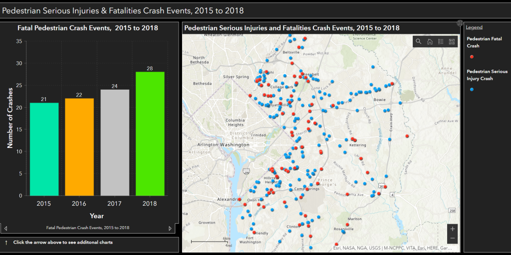
The Prince George’s County Department of Public Works and Transportation, in collaboration with the University of Maryland College of Information Studies (UMD iSchool), released a new online tool mapping pedestrian and traffic accidents across Prince George’s County, Maryland. This tool is part of the Vision Zero Prince George’s initiative launched by the county in 2019, which aims to eliminate traffic fatalities and serious injuries by 2040.
The tool, or “dashboard,” was developed by a team of students at the UMD iSchool, led by PhD Candidate TJ Rainsford and the Strategic Transformation Advisor at Dataprise, a Maryland-based IT services and support consultancy. Using geological data from the past four years – provided by the county and the Maryland Department of Transportation – the dashboard consists of various interactive maps that allow viewers to hone in on specific roadways and intersections in the county showing the exact location of reported crashes, dates the crashes occurred, the type of transportation involved, including pedestrian and motorcyclist accidents, and total number of people involved and the severity of their injuries.
This data visualization tool will help county officials and local communities to hone in on and implement remediations in high-crash-risk locations. The teams working on the Vision Zero project are enthusiastic about this new dashboard providing a data-driven, holistic view that can guide strategic allocation of resources and support their goal of eliminating traffic fatalities and serious injuries by 2040.
To learn more about the Vision Zero initiative, visit the Vision Zero dashboard.